 Hardware Ready Ready to Bench?
NASA has released satellite images showing significant ripples in the upper atmosphere caused by Hurricane Simon, which formed off the Pacific coast of Mexico. The footage, captured during a nighttime pass of the NOAA-21 satellite, reveals how storm movements can extend far beyond the clouds.
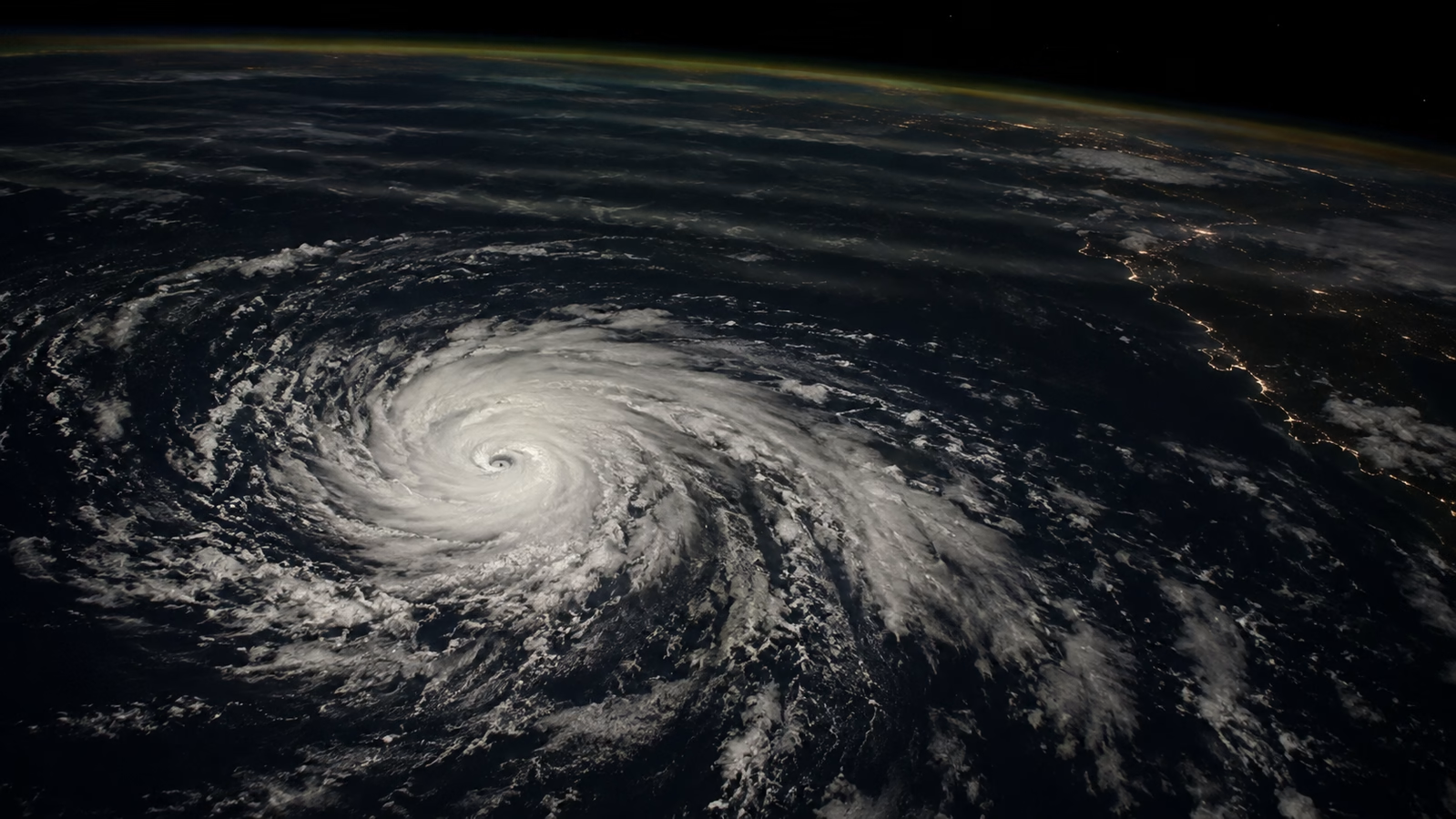
These structures become visible due to their interaction with the faint natural glow of atmospheric gases. Hurricane Simon had reached Category 4, with sustained winds up to 250 kilometers per hour, approaching within about 50 kilometers of the coast between Manzanillo and Puerto Vallarta. Although remaining in open waters, the cyclone caused heavy rains and flooding in coastal communities, including the port city of Manzanillo.
Hurricane Simon: why it matters
An instrument called VIIRS (Visible Infrared Imaging Radiometer Suite), aboard the Suomi NPP satellite, documented the storm’s structure during an afternoon observation. At that time, according to the National Hurricane Center, sustained winds had dropped to about 210 kilometers per hour, but the hurricane’s core remained close enough to the coast to pose a threat to populated areas.
The waves generated by a hurricane can reach the mesosphere and become visible due to variations in the atmosphere’s faint natural glow. These nighttime ripples are originated by the storm’s powerful convective motions: near the eyewall, water vapor condensation releases latent heat, fueling the ascent of warm, moist air.
This forms towering cumulonimbus clouds, whose strong updrafts disturb the surrounding atmosphere and can generate waves capable of propagating to higher altitudes. These are atmospheric gravity waves: oscillations of air in which gravity acts as a restoring force after a disturbance. These waves can traverse the stratosphere and reach the mesosphere, transferring the effects of underlying motions.
Their propagation depends on the atmospheric conditions encountered along the path: strong high-altitude winds can attenuate or disperse them before they reach the observable region. In the mesosphere, airglow comes into play, a weak natural light emission produced by gases in the upper atmosphere. The passage of waves modifies the brightness of this layer, creating ripples.
What changes and what are the effects
The satellite therefore records variations in atmospheric glow through which the phenomenon can be recognized, well above the tops of thunderstorm clouds. VIIRS’s day-night band is sensitive enough to detect this dim light, but it also collects moonlight reflected from the Earth’s surface and atmosphere. Strong lunar illumination can make it more difficult to distinguish the airglow signal.
During the pass over Simon, moonlight was very scarce, a favorable condition that allowed delicate brightness variations to emerge in the satellite image.
Source and further reading on Hurricane Simon: original article.
* Content created with the assistance of artificial intelligence systems.